Minturn Trails
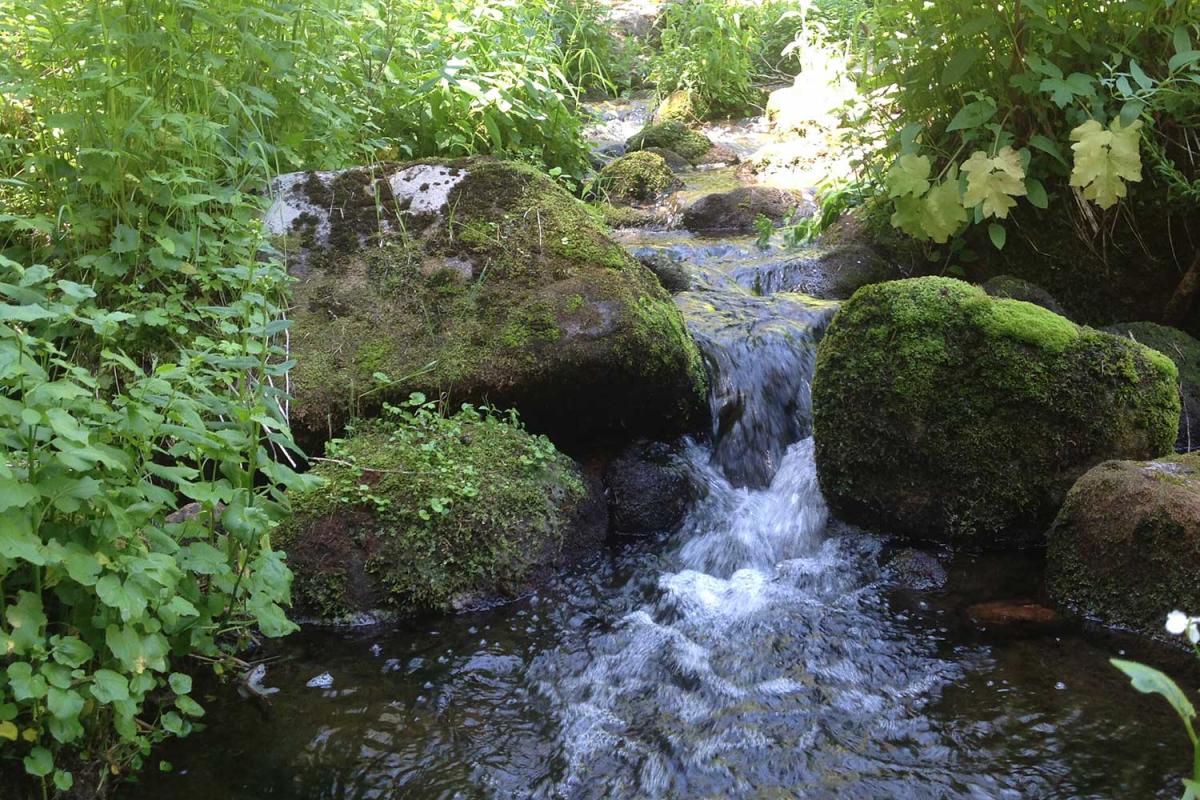
As the gateway to the White River National Forest and the Holy Cross Wilderness, Minturn’s backyard features mountains to climb, snow to shred, trails to ride, and rivers to fish. We hope you enjoy the area as much as we do.
To enhance conservation efforts for the thousands of acres of public lands surrounding the destination, the Towns of Minturn encourages all visitors and residents to follow outdoor recreation principles each time they visit and recreate in the great outdoors. For more information and tips about how you can recreate responsibly, please click HERE.
Hiking, Biking, Horseback Riding, Snowshoeing and Cross Country Skiing
The Holy Cross District has 225 miles of Forest Service trails. These trails offer a variety of opportunities for hiking, horseback riding, mountain biking and, in winter, cross-country skiing and snowshoeing. For information about elevation and difficulty, stop by the White River National Forest Office at I-70 Exit 171 or call (970) 827-5715.
For information on hunting, please visit the Colorado Parks and Wildlife website at https://cpw.state.co.us/thingstodo/Pages/HuntingSeasonDatesAndFees.aspx.
For information about seasonal trail closures in the Eagle Valley, please visit: https://www.vvmta.org/seasonaltrailclosures/.
For comprehensive trail details, including current trail conditions, visit https://www.vvmta.org/trailconditions/
For information on COTrex (Colorado Trails Explorer), which includes route information for hiking, biking, horseback riding, nordic skiing, snowshoeing, snowmobiling, and motorcycle/OHV/ATV riding, visit http://trails.colorado.gov or download the COTrex app on your mobile device.
In addition to exploring our trails on your own, Walking Mountains Science Center offers several guided hikes, snowshoe hikes, and nature walks. For more information, visit the Things to Do section of their website.
CAMPING:
Please note, there is no camping within the Town of Minturn. The nearest camping is at Halfmoon Campground at the top of Tigiwon Road # 707, near the boundary for the Holy Cross Wilderness in a forested setting. This is a first come, first serve campground. All wilderness regulations must be observed when traveling in the wilderness (foot and horse travel only). This campground is located at the trailheads for several hiking trails and is heavily used by hikers who are climbing Mount of the Holy Cross. Due to the nature of the Forest Road to the campground and the short parking spurs within the campground, the Halfmoon Campground is not suitable for most RVs. There is a printable Recreation Quicksheet for this campground which is complete with directions, details, and other information about this campground.
Additional camping is available at the nearby Camp Hale Memorial Campground. Camp Hale was recently named a National Monument, and offers a wonderful setting for recreation and relaxation. This campground is located in the Camp Hale National Historic Site about 15 miles south of Minturn, CO in a wide, flat, open valley sparsely forested by lodgepole pines. There are 21 campsites available, at an elevation of 9,200 feet. It is near the headwaters of the Eagle River with the East Fork River close by. The Colorado Trail crosses within walking distance and the gravel roads in the Camp Hale area provide easy walking and bike paths. Fishing is also available in numerous small streams nearby.
Camp Hale is historic because the 10th Mountain Division, an unit of 15,000 men, trained here in mountaineering and skiing techniques during WWII. Some saw combat in Italy during the war. Most of the buildings have been torn down, but foundations and other "footprints" remain. The 99th Infantry Battalion (Viking Battalion) also trained at Camp Hale. There are interpretive signs along US Route 24, explaining the history and accomplishments of Camp Hale.
Camp Hale was the center of mountain and winter warfare training developed by the United States Army during World War II. The camp was located here because of the site's natural features and ready access. When the war broke out this valley was served by both a federal highway and the Denver and Rio Grande Western Railroad. Moreover, the large open valley had adequate room for the camp including more than 1,000 buildings and structures as well as parade grounds, weapons ranges, and other spaces needed by the Army. There is a self-guided tour with 10 stops that take you in a loop around Camp Hale. Each stop has an interpretive sign with history of that area. Their is a larger interpretive site just off Highway 24 marked by stone pillars at the main entrance to Camp Hale about 17 miles south of the intersection of I-70 and Hwy 24.
For information on other camping areas in the region, visit https://www.fs.usda.gov/.
Minturn-Area Trails:
Minturn Mile: The Minturn Mile is one of the most famous "off-piste" or "out-of-bounds" ski runs in the world. It is important to know that if you come down the Minturn Mile that you have left Vail Mountain and are in terrain that is not patrolled. You may unintentionally spend more time out there than you planned. That being said, it is a great run and a wonderful experience best done with friends and ending at the Minturn for refreshments. More Information
The Minturn Mile in the summer is known as the Game Creek Trail. The Minturn Mile sees thousands of skiers making the exciting journey from Vail Mountain to the small town of Minturn every winter, but many of those skiers don't realize it's also a fun route to enjoy in the summer. Open to hikers, bikers and horseback riders. Map
Minturn Mini Mile: This short beginner singletrack is great for kids. Newly built in 2017, this loop has around 150-200 feet of elevation change. With moderate grades and a forgiving tread, this is great for beginners to practice skills.
Map and Mtn bike map. Seasonal wildlife closure December 1 - May 1. *Closed to all users (foot, bike, & equestrian).
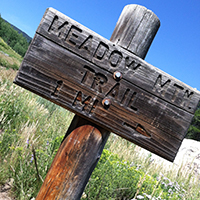 Meadow Mountain: Great for hiking or snowshoeing. Travel south for 300 feet, the Holy Cross Ranger District is located here. Park in the dirt parking lot. The trailhead is located by the white house. Map.
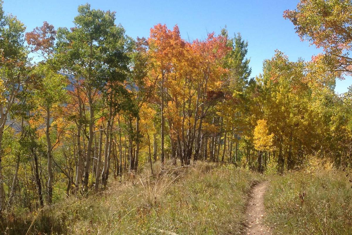
Everkrisp Trail: This is a new trail in 2019. This trail is a connection from Minturn to the Eagle Vail Trail. This also gives legal access to the Whiskey Creek trail. Great for hiking and biking. Can be accessed on the Minturn side from the Meadow Mountain trailhead.
In the 1920's, the meadows in this area were the property of the Everkrisp Lettuce Company (I kid you not - Minturn was "the lettuce capital of America"). Hence the name!
The trail includes moderate climbs on switchbacks, deep and beautiful aspen forests, open meadows (filled with wildflowers in July and early August), and great views of the surrounding mountains. More information can be found on https://www.trailforks.com/trails/everkrisp-153525/, and https://www.mtbproject.com/trail/7048694/everkrisp. Seasonal wildlife closure November 23 - June 20. *Closed to all users (foot, bike, & equestrian).
Grouse Mountain / Grouse Creek: Great for hiking or showshoeing. Proceed 1 mile on US HWY. 24 south to trailhead across from Meadow Mountain Business Park. Map.
Grouse Lake: Proceed 1 mile on US HWY 24 south to trailhead across from Meadow Mountain Business Park. Map.
Lionshead Rock via Cougar Ridge Trail: Lionshead Rock via Cougar Ridge Trail is a 4 mile moderately trafficked out and back trail located near Minturn, Colorado that features beautiful wild flowers and is rated as moderate. The trail offers a number of activity options. Dogs are also able to use this trail but must be kept on leash. Map
Two Elk Trail: Travel south for 2.5 miles to Cemetery Road in Minturn. (Look for the bridge across the river). Turn left on Cemetery Road and continue on the road to the fork. Take the right fork, where the road forks again, take the left fork and follow this to the end of the road. Map. Seasonal wildlife closure May 6 - June 30. *Closed to all users (foot, bike, & equestrian).
Cross Creek Access from Tigiwon Road: I-70 to Exit 171 (Hwy. 24/6), travel south on US HWY. 24 for 4 miles to Tigiwon Road FDR 707. Proceed 2 miles on Tigiwon Road to trailhead on right. Map. Tigiwon Road is closed to all motor-vehicles annually from May1 to June 21st. It reopens to motorized vehicles on June 21st if the road is snow-free.
Martin Creek Trail: The Martin Creek trail begins in Minturn and ends at Grouse Mountain Trail #2010: The trail climbs steadily as it follows an old road through aspen and then lodgepole. The trail passes the remains of several old cabins and offers good views of Cross Creek Valley and Mount of the Holy Cross. At about 6 miles, hikers can turn right onto the Grouse Mtn Connector Trail #2010 toward West Grouse Creek Trail #2129 or continue left toward Cross Creek Trail #2006. Map.
Halfmoon Pass, Mt. of the Holy Cross, and Fall Creek Trails: Proceed 8 miles on Tigiwon Road to the end of the road. Tigiwon Road is closed to all motor-vehicles annually from May1 to June 21st. It reopens to motorized vehicles on June 21st if the road is snow-free. Halfmoon Pass Map. Mount of the Holy Cross Map. Fall Creek Trail Map.
Notch Mountain Access from Homestake Road: I-70 to Exit 171 (Hwy. 24/6), travel south on US HWY. 24 for 14 miles to Homestake #703. Same as Fall Creek trailhead. Hike the Fall Creek trail for 2 miles to the junction with Notch Mountain trail. Map
Whitney Lake: Turn right off of HWY 24 onto Homestake Road # 703 and proceed 5 miles to trailhead. Map
Missouri Lakes/Fancy Pass: Travel on Homestake Road # 703 for 7 1/2 miles to Missouri Creek Road #704. Turn right and continue for 1 1/2 miles. Map
East Fork/Lonesome Lake: Proceed approximately 10 miles on Homestake Road #703. Trailhead on left. Map